Mappy route planner: practical guide to calculate and compare your trips
To create a Mappy route, enter your starting point and destination, choose your mode of transportation, then compare the suggested routes based on time, distance, traffic, and tolls. You can then print the itinerary, share the route, or restart the search from your current location.
Mappy is presented as a map and route comparison tool. The tool is useful when you want to go quickly, avoid toll costs, prepare a trip on foot or by bike, or simply verify that an address is correctly found before leaving. This guide goes straight to the point, with concrete steps, selection criteria, and troubleshooting solutions.
In brief
🧭 Mappy route planner is used to calculate a route, then compare several options before departure.
🚗 By car, the tool highlights time, distance, traffic, and, when applicable, the toll-free option.
📍 An address, city, or point of interest can serve as a start or end point, simplifying the search.
🖨️ Printing, sharing, and starting from the current position are the most practical features for daily use.
What does Mappy allow you to do for a route?
Mappy is a mapping service that allows you to search for a place, calculate a route, and compare several itineraries based on the chosen mode of transportation. In practice, the tool is used to prepare a departure without mistaking the address, to choose between speed and distance, and to visualize the route before taking it.
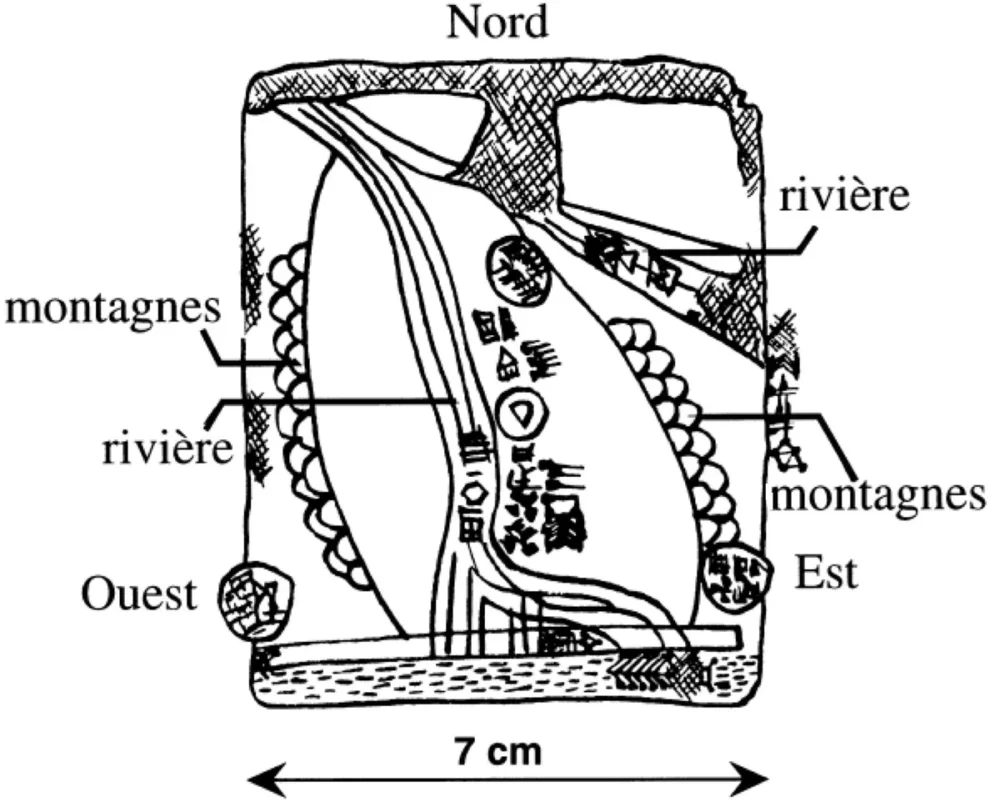
- Route calculation from a starting point to a destination.
- Comparison of several routes depending on the mode of transport.
- Traffic display to better understand driving time.
- City map and useful landmarks to find an address or a specific place.
The right approach is to treat Mappy as a decision-making tool, not just as a map. A route can be shorter in kilometers but longer in duration, especially when traffic slows down or when tolls change the suggested route. That is why comparison is as important as calculation.
The right route is not always the shortest: it is often the one that fits your current constraint.
What do you need before launching Mappy?
A Mappy route can be prepared in seconds if the basic information is ready. Most often, a start, a destination, and a mode of transport are enough. However, an incomplete address, an approximate GPS, or a misspelled city can distort the result, which is better to avoid at the input stage.
Before starting the search, keep the following elements handy:
- The starting point: address, city, locality, or current position.
- The destination: full address, name of a business, or point of interest.
- The mode of transport: car, walking, bike, or public transport as needed.
- The context: departure time, presence of tolls, need to avoid congested routes.
How to create a route on Mappy step by step?
Mappy’s route calculation is based on simple input, then on a choice of route. The logic remains the same on computer and mobile: enter the departure point, enter the arrival point, select the mode of transport, then read the displayed options. This process avoids vague searches and gives you an immediately usable route.
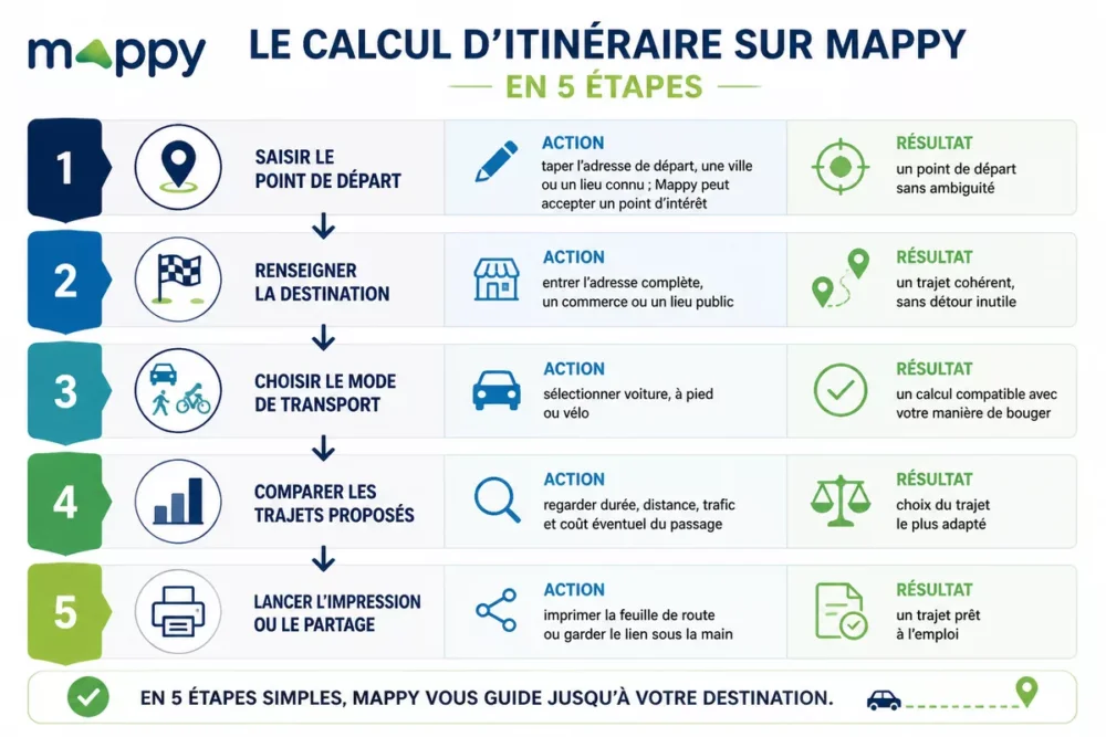
Step 1: enter the starting point
Start by typing the departure address, a city, or a known place. Depending on the case, Mappy also accepts a point of interest. This first input must be precise, as an incomplete street or a homonymous town can send the route to the wrong place. The expected result is simple: an unambiguous starting point.
Step 2: enter the destination
Next, enter the complete destination. An address, a business, or a public place works better than a too vague name. If the arrival corresponds to a dense city center, check the label proposed by Mappy before validating. The expected result is a coherent route, without unnecessary detours from the start.
Step 3: choose the mode of transport
Select the mode suited to the trip. Mappy offers different routes depending on whether you travel by car, on foot, or by bike. A pedestrian route does not follow the same roads as a car route, which also changes the displayed duration. The expected result is a calculation compatible with your way of moving.
Step 4: compare the proposed routes
Look at the variants displayed by Mappy before clicking on the first option that comes up. The fastest is not necessarily the clearest, and the toll-free route is not always the shortest in time. The right reflex is to compare duration, distance, traffic, and any toll cost.
Step 5: start printing or sharing
Once the route is chosen, print the itinerary sheet or keep the link handy to open it on mobile. This step avoids redoing the search at the last minute, especially if the connection is weak or if you need to send the route to someone else. The expected result is a ready-to-use route.
What type of route to choose on Mappy?
The right choice depends on your main constraint. Mappy generally highlights several route logics, allowing you to balance speed, kilometers traveled, and toll costs. For practical use, the question is not just “which route is the shortest?” but “which route fits my current need?”.
| Type of route | What Mappy aims to optimize | When to choose it | Point of caution |
|---|---|---|---|
| The fastest | Travel time | When time matters more than distance | May go through busy or toll roads |
| Toll-free | Cost of passage | When you want to limit road expenses | May increase duration or distance |
| The shortest | Number of kilometers | When you want a compact route | Not always the best choice in urban traffic |
| According to mode | Type of movement | On foot, by bike, or public transport | Traffic rules change depending on the mode |
A toll-free route can save a paid passage, but not necessarily time. The real comparison is always made over the entire route.
Here is a simple grid to decide quickly:
- Priority to time: choose the fastest route.
- Priority to budget: try the toll-free option.
- Priority to simplicity: look at the most direct route by landmarks.
- Priority to soft mobility: switch to bike or walking.
How to compare car, bike, pedestrian, and public transport on Mappy?
Comparing modes of transport on Mappy allows you to see at a glance that the best route depends on the actual journey. A car route can be optimized for traffic, while a pedestrian route must avoid prohibited or inconvenient roads. The principle is simple: the same start and the same destination do not yield the same result depending on the chosen mode.

To compare properly, always look at these four criteria:
- Estimated duration: useful for deciding between two similar routes.
- Distance: practical to limit effort or consumption.
- Route comfort: important when walking or biking.
- Local constraints: one-way streets, pedestrian zones, expressways, or transfers.
Step 1: test the same start on two different modes
Keep the same starting address and only change the mode. The contrast between car and pedestrian, or between bike and car, immediately shows if the proposed route is realistic. The expected result is a finer understanding of what Mappy displays to you.
Step 2: spot the duration differences
Then compare the displayed times. A difference of a few minutes can be insignificant, but a larger gap often signals a real difference in the route. The expected result is a stronger choice, especially if you are leaving at a busy time.
How to print, share, or start again from your position?
Printing a Mappy route or starting a journey from your current position mainly helps save time at departure. The print function remains useful if you want a readable roadmap without constantly opening your phone. Starting from the current position avoids having to enter a starting address already known by the GPS.
The most useful uses are the following:
- Print the route before leaving to keep a paper copy.
- Share the link with another person to avoid duplicate searching.
- Start again from the current position when you are already on the move.
- Restart a search if the starting address changed at the last minute.
A printed route does not replace real-time GPS, but it secures preparation. This is especially useful for an appointment, a family trip, or an outing in an area poorly covered by the network.
What do the displayed time, distance, and traffic mean?
The time displayed by Mappy is an estimate, not a promise set in stone. The distance indicates the route traveled, while the traffic modifies the probable duration, especially when driving. Together, these three pieces of information help to understand whether the trip is fast, short, or only theoretically efficient.
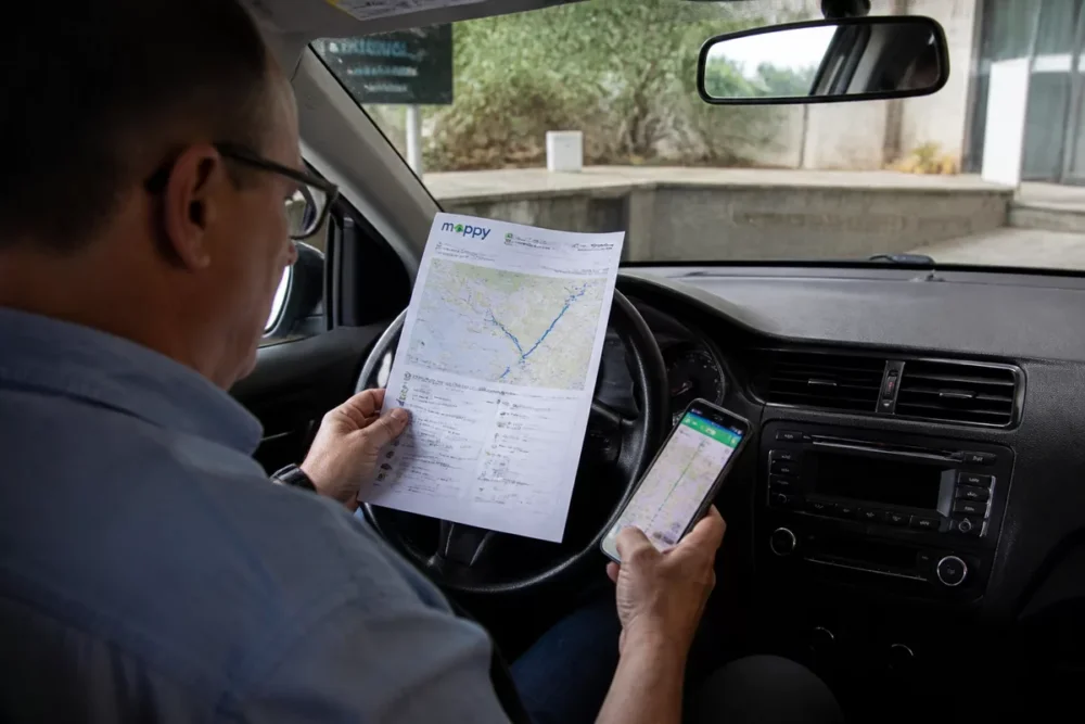
To correctly read a route sheet, remember this logic:
- Time is used to compare the overall efficiency of the trip.
- Distance is used to judge the actual length of the route.
- Traffic is used to anticipate slowdowns and duration variations.
- Tolls are used to estimate the budgetary impact of a car trip.
A correct address, an appropriate mode of transport, and an eye on traffic are often enough to avoid a bad route.
Why can a Mappy route change or get blocked?
A route can change because the initial input is not precise enough, because the departure time influences traffic, or because the selected mode of transport does not match the real need. A blockage can also come from an unfindable address, an imprecise GPS, or a weak connection at the time of calculation.
When the route does not match what you expected, first check these points:
- The spelling of the departure and arrival addresses.
- The mode of transport selected in Mappy.
- The level of detail of the address, especially in the city.
- The current departure if you are using geolocation.
- The consistency of the route if you are looking for an option without tolls or highways.
The best practice is to correct one variable at a time. If you change everything at once, you won’t know which action unlocked the search. This simple method avoids a lot of wasted time, especially on mobile.
Mappy compared to other navigation tools
Mappy remains interesting when you are looking for a map and route comparator with a very readable route logic. The tool is particularly practical if you want to visualize a city map, compare several route options, or prepare a simple roadmap. The right choice therefore depends less on the “app” effect than on the real need at the moment.
| Tool | Practical advantage | Common limitation | Relevant use |
|---|---|---|---|
| Mappy | Route comparison and readable map | Depends on input precision | Prepare a route, print, compare |
| Classic navigation app | Continuous guidance during the trip | Less focused on map reading | Follow a route in real time |
| Paper map or static plan | Very simple overall view | No traffic or recalculation | Understand an area or organize orientation |
In practice, Mappy is useful when you want to prepare the route before leaving, while another tool may be more comfortable for following the road while driving. This division of roles avoids asking a single interface to do everything, which is often the source of disappointments.
Useful Sources to Consult
The official Mappy pages remain the best basis for checking route functions, maps, and offered options. When in doubt, it is better to return to the source rather than rely on an approximate summary. Here are the most useful pages to cross-check information.
| Source | Useful Data | Practical Use | Attention |
|---|---|---|---|
| Mappy – route | Route calculation, comparison, road options | Prepare a car or multimodal trip | Check the input of departure and arrival |
| Mappy – homepage | Maps, place search, routes | Quick access to the main search | Review the active option before starting the calculation |
| Mappy – maps | City, street, and place maps | Locate an address or neighborhood | Confirm the correct zoom level and area |
Key Points
- 🧩 A good Mappy route starts with precise entry of departure and arrival.
- 🚙 The fastest route is not always the most economical or the simplest.
- 📄 Printing and sharing remain useful for preparing a stress-free trip.
- 🛰️ Current location and traffic can affect the displayed result.
- 🔎 A misspelled address often suffices to distort the search.
Frequently Asked Questions
How to create a route on Mappy?
Enter your starting point, then your destination, and choose your mode of transport. Mappy then calculates several possible routes with their time, distance, and, for car, constraints such as traffic or tolls. The safest method is to verify the address before confirming.
Can you print a Mappy route?
Yes, printing a roadmap is possible after calculating the route. This option remains practical if you want to keep a paper copy, especially when mobile connection is uncertain or when several people need to follow the same route.
How to calculate a toll-free route on Mappy?
Choose the appropriate route option among the variants offered for the car. The benefit is clear: you limit tolls, but the route may become longer in time or kilometers. Reading the travel time should therefore remain your first reflex.
Does Mappy work from my current location?
Yes, Mappy can calculate a route from the current location if geolocation is available and sufficiently accurate. This function is useful when you are already on the move and do not want to re-enter your departure address.
Why does the displayed route change between two searches?
The route can change if the departure time, traffic, or mode of transport are no longer the same. An imprecise address can also modify the route. When the result is surprising, check one variable at a time to identify the real cause.