.synthesis { max-width: 640px; margin: 2em auto; padding: 1.5em 1.8em; color: #05243e; font-family: “Inter”, “Segoe UI”, sans-serif; text-align: left; position: relative; box-sizing: border-box; background: #dfebf5; border: 1px solid #1069b5; border-left: 6px solid #1069b5; border-radius: 12px; box-shadow: 0 8px 24px rgba(251, 191, 36, 0.15); }
.synthesis h2, .synthesis .synthesis-header { font-size: 1.15em; font-weight: 700; margin-bottom: 0.6em; background: linear-gradient(90deg, #1069b5, #101cb5); -webkit-background-clip: text; background-clip: text; color: transparent; }
.synthesis p, .synthesis li { font-size: 1em; line-height: 1.65; margin: 10px; }
.synthesis strong { color: #031524; }
.synthesis::before { content: “\201C”; position: absolute; top: 0.05em; left: 0.25em; font-size: 3.2em; line-height: 1; color: rgba(16, 105, 181, 0.22); font-family: Georgia, serif; pointer-events: none; }
.synthesis { padding-left: 2.2em; }
.synthesis > p:first-of-type::first-letter { font-size: 2.4em; float: left; line-height: 0.9; margin: 0.05em 0.12em 0 0; color: #1069b5; font-weight: 700; }
.synthesis table { width: 100%; border-collapse: collapse; }
.synthesis th { background: rgba(16, 105, 181, 0.12); color: #0c528d; text-align: left; }
.synthesis td, .synthesis th { padding: 8px 12px; border-bottom: 1px solid rgba(16, 105, 181, 0.18); vertical-align: top; }
.synthesis tbody tr:nth-child(even) { background: rgba(16, 105, 181, 0.05); }
.magic-lb-overlay{position:fixed;inset:0;background:rgba(15,23,42,.92);display:none;align-items:center;justify-content:center;z-index:99999;cursor:zoom-out;padding:20px}
.magic-lb-overlay.open{display:flex}
.magic-lb-overlay img{max-width:95vw;max-height:95vh;object-fit:contain;border-radius:8px;box-shadow:0 8px 32px rgba(0,0,0,.5)}
.magic-lb-close{position:absolute;top:16px;right:20px;color:#fff;background:rgba(0,0,0,.5);border:none;width:40px;height:40px;border-radius:50%;font-size:24px;cursor:pointer;display:flex;align-items:center;justify-content:center}
.magic-lb-close:hover{background:rgba(0,0,0,.8)}
.wp-block-image img{cursor:zoom-in;transition:transform .15s ease}
.wp-block-image img:hover{transform:scale(1.01)}
.magic-img-link{display:inline-block;text-decoration:none}
(function(){
var ov=document.getElementById(‘magic-lb’);if(!ov)return;
var img=ov.querySelector(‘img’),btn=ov.querySelector(‘.magic-lb-close’);
function open(src){img.src=src;ov.classList.add(‘open’);document.body.style.overflow=’hidden’}
function close(){ov.classList.remove(‘open’);img.src=”;document.body.style.overflow=”}
document.addEventListener(‘click’,function(e){
var a=e.target.closest(‘a.magic-img-link’);
if(a){e.preventDefault();open(a.getAttribute(‘href’));return}
var i=e.target.closest(‘.wp-block-image img’);
if(i&&!e.target.closest(‘a’)){e.preventDefault();open(i.currentSrc||i.src)}
});
ov.addEventListener(‘click’,function(e){if(e.target===ov||e.target===btn)close()});
document.addEventListener(‘keydown’,function(e){if(e.key===’Escape’)close()});
})();
Mappy vs Google Maps: which tool to choose to prepare a trip?
| 🧭 Comparison | Mappy vs Google Maps pits a tool very focused on route calculation against a more comprehensive navigation solution. |
| 🚗 Road use | Mappy remains practical for preparing a readable car trip, with tolls and fuel estimation. |
| 📍 Navigation | Google Maps stands out for real-time traffic, Street View, reviews, and mobile integration. |
| 💶 Budget | The cost of the trip can weigh as much as the duration, especially on a highway trip of 300 to 800 km. |
| 🔒 Data | Privacy becomes a real criterion if you limit sharing your locations and travel habits. |
| ✅ Verdict | The best choice depends on the context: simple trip, holiday departure, dense city, rural area or daily use. |
Mappy vs Google Maps is a bit like the match between old-fashioned route preparation, clear and structured, and connected navigation that can do almost everything. Before a departure, especially when tolls, fuel, traffic jams or an unknown address are involved, the choice of tool can really change the experience. That’s why it’s not enough to ask “which is better”: you mainly need to know which is best suited to your trip.
Mappy vs Google Maps: what exactly are we comparing?
Comparing Mappy and Google Maps comes down to comparing two approaches. Mappy is often used to prepare a clear road route, with simple reading of the itinerary and particular attention to cost. Google Maps, on the other hand, works as a complete ecosystem: navigation, traffic, businesses, transport, reviews, photos, Street View and mobile synchronization.
Mappy: a tool focused on route preparation
Mappy still appeals to many French drivers because it goes straight to the point: a starting point, a destination, several routes, directions, and often a cost estimate. For a driver preparing a trip before leaving, this simplicity has real value. No need to get lost in a flood of options when the goal is just to understand where to go.
In practice, Mappy is particularly useful for road trips where budget matters: tolls, fuel, distance and duration. A one-way trip Paris–Bordeaux is for example about 580 km via the A10, with several tens of euros in tolls depending on the vehicle and the tariff period. In this kind of situation, a tool that clearly displays costs avoids unpleasant surprises. To go further on this point, the guide dedicated to Mappy route calculation precisely details the practical options to check.
Google Maps: a more comprehensive navigation solution
Google Maps is not limited to route calculation. The app also serves to search for an address, check business hours, read reviews, view a street with Street View, compare car, walking, cycling and public transport, then launch guided navigation. In other words, it supports the user before, during and sometimes after the trip.
Its big strength remains real-time traffic. On an urban trip of 25 minutes under normal conditions, a disruption can easily add 10 to 20 minutes during rush hours. Google Maps often adjusts the route based on detected slowdowns, making it very convenient in large urban areas like Paris, Lyon, Marseille or Lille.
What criteria to consider when preparing a trip?
The classic trap is to compare only the displayed minutes. However, a 3 h 10 trip can be less interesting than a 3 h 25 trip if it costs an extra €25 in tolls, passes through a zone known for traffic jams, or requires unclear changes in direction. Joking aside, no one wants to gain 8 minutes on paper only to get stuck at a poorly marked exit.
Travel time, traffic, and departure time
The departure time changes everything. A Nantes–Rennes trip, about 110 km via the N137, can be smooth in the middle of the day and much more congested on Friday evening. Google Maps generally has the advantage thanks to updated traffic data, while Mappy remains interesting for calmly visualizing the route before hitting the road.
For public traffic and infrastructure data, the data.gouv.fr portal on road traffic allows access to institutional datasets published by various local authorities and administrations. This information reminds us of one thing: the reliability of a route also depends on the quality of locally available data.
Readability of steps and alternatives
Readability matters more than one might think. Before an unknown trip, many users simply want to know if they are taking the highway, a national road, a ring road, or a secondary route. Mappy is often appreciated for this more straightforward reading, especially from a computer. Google Maps, on the other hand, displays a lot of information around the route, which can be very useful… or a bit cluttered depending on the user profile.
- For a simple trip, favor the tool that clearly displays the main stages and important exits.
- For an urban trip, especially check real-time traffic and any traffic restrictions.
- For a long trip, compare duration, tolls, estimated consumption, and possible breaks.
- For a business trip, keep a safety margin of 15 to 30 minutes depending on the distance.
Trip cost, tolls, and fuel
The total cost is one of the criteria where Mappy stands out. On a highway trip of 500 to 700 km, tolls can represent around €40 to €80 depending on the route, vehicle class, and sections taken. Added to this is fuel, which depends on actual consumption, price per liter, and driving style.
Google Maps sometimes displays economic information, but its main logic remains navigation and trip optimization. Mappy, on the other hand, maintains a more budgetary approach. This is particularly appreciated for a family preparing a vacation, a freelancer billing their trips, or a driver wanting to choose between a fast highway and a cheaper national road.
Coverage, updates, and field reliability
On the ground, differences between tools appear mainly outside major routes: recent housing developments, modified one-way streets, temporarily closed roads, new business areas. Google Maps benefits from a very large user base and reports, which helps quickly spot certain changes. Mappy can remain perfectly sufficient on classic routes, but it deserves to be cross-checked when the address is isolated or recent.
Mappy or Google Maps: features, accuracy, and daily coverage
On a daily basis, Google Maps is often more versatile, while Mappy remains more straightforward for preparing a road trip. If you alternate between car, walking, cycling, public transport, and place searches, Google Maps takes the lead. If you mainly want to calculate a clear car route with cost estimation, Mappy remains a credible option.
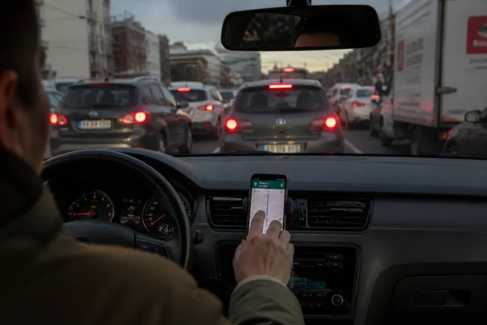
Car, bike, pedestrian, and public transport routes
Google Maps generally covers more scenarios. In the city, it allows you to quickly switch from a car trip to a pedestrian, bike, or public transport route. In Paris, Lyon, or Strasbourg, this versatility is very useful, as the best choice is not necessarily the car. Between an 18-minute metro ride, a 22-minute bike ride, and a car stuck in traffic, the decision can quickly change.
Mappy better meets a more focused need: preparing a road trip, understanding the distance, identifying main roads, and anticipating costs. If you first need to precisely search for a destination, the tutorial on address search on Mappy can help avoid input errors, especially with localities, nearby postal codes, or common street names.
Map accuracy and points of interest
Google Maps often dominates in points of interest: restaurants, parking lots, gas stations, hotels, charging stations, open shops. This richness comes from multiple sources: establishment data, user contributions, photos, reviews, and regular updates. To find a nearby gas station or check if a parking lot is close to a train station, it’s very practical.
Mappy is less sprawling, but this simplicity can also be an advantage. The interface places less emphasis on the commercial universe and more on the route. For users who want to avoid distraction, this is quite comfortable. Cherry on the cake: on a computer, route preparation often remains pleasant to read.
Accessibility, mobile, and connected car
Google Maps benefits from strong integration with Android, Android Auto, and many mobile uses. It is also very present on iPhone, even if Apple Maps is a natural alternative within the Apple ecosystem. This integration matters a lot when moving from the office to the phone, then from the phone to the car screen.
Mappy remains usable on browser and mobile, but its main interest lies more in preparation than in the complete onboard experience. In other words: if you prepare your trip calmly before leaving, Mappy does the job. If you want active, recalculated, connected navigation enriched with multiple pieces of information, Google Maps logically takes the lead.
| Criterion | Mappy | Google Maps | To prefer if… |
|---|---|---|---|
| Car preparation | Very readable | Very complete | You compare distance, stages, and cost |
| Real-time traffic | More limited depending on usage | Major strength | You drive in the city or during rush hours |
| Tolls and fuel | Often very practical | Less central | You prepare a long road trip |
| Pedestrian, bike, public transport | Variable depending on areas | Generally richer | You use several modes of transport |
| Points of interest | Good for the essentials | Very dense | You look for shops, reviews, or opening hours |
Privacy, personal data, and French alternatives
Navigation relies on sensitive data: location, search history, frequent routes, visited places, and times. Google Maps offers a very rich experience but tied to the Google ecosystem. Mappy is often seen as a more sober French alternative, even if any mapping service involves a minimum of data processing.
Why does privacy matter when choosing a GPS?
A route tool does not handle trivial data. Your location can reveal a home, a workplace, a medical visit, a sports habit, or a regular trip. According to the CNIL on geolocation, location data must be given special attention, as it can be very revealing of private life.
Overall, Google Maps offers a lot in terms of comfort: history, recommendations, personalized routes, contextual search. In exchange, the user must understand privacy settings, location history, and deletion options. Mappy, on the other hand, sometimes attracts those who want an experience less integrated with a major personal account.
Mappy versus Google Maps, Waze, and Apple Maps
To compare honestly, alternatives must also be mentioned. Waze, also owned by Google, is highly appreciated for community reports: accidents, hazards, slowdowns, controls reported by users. Apple Maps has significantly improved in recent years and may suit iPhone users who want to stay within the Apple ecosystem.
In short, the match is not limited to Mappy vs Google Maps. For active car navigation, Waze can be formidable. For simple iPhone use, Apple Maps may suffice. To prepare a road route in advance with a clear view of the cost, Mappy still holds a real place. To do everything in a single tool, Google Maps remains hard to beat.
- Choose Mappy if your priority is clear preparation of a car trip with visible costs.
- Choose Google Maps if you want a complete, connected, multimodal solution rich in local data.
- Choose Waze if you drive a lot and real-time community reports are decisive.
- Choose Apple Maps if you are on iPhone and prefer simple integration with iOS.
How to choose between Mappy and Google Maps: the steps
The best method remains very simple: do not choose the tool in the abstract, choose it based on your actual route. A Paris–Deauville trip on a Friday evening, a Lyon–Grenoble trip during the week, or a rural trip to a cottage in the Lot do not pose the same problems. That is why a quick comparative test is better than a general opinion.
- Enter exactly the same address in Mappy and Google Maps, checking the postal code, municipality, and any homonyms.
- Compare the announced duration at the same time, because a 5-minute difference can become 25 minutes if traffic changes.
- Look at the logic of the route: highway, national road, bypass, city crossing, small roads, or areas prone to errors.
- Check the estimated cost, especially tolls and fuel for trips over 200 km.
- Test the arrival address with sufficient zoom, especially in rural areas, recent housing developments, or commercial zones.
- Keep the clearest tool if the results are close, as a good reading before departure avoids many hesitations.
What mistakes to avoid with Mappy vs Google Maps?
The most frequent mistakes rarely come from the tool alone. They rather come from an incorrectly entered address, excessive trust in the displayed duration, lack of cost verification, or inappropriate use for the context. In other words, even the best GPS does not completely replace a minimum of human control.
Mistake #1: comparing two routes at different times
Comparing Mappy at 10 a.m. and Google Maps at 6 p.m. doesn’t make much sense. Traffic, roadworks, and slowdowns change throughout the day. For a 40 km trip around Bordeaux or Montpellier, the difference between off-peak and rush hour can exceed 20 minutes. Therefore, you need to test both tools at the same time, or use the planned departure options when they are available.
Error #2: neglecting tolls on long trips
On a highway trip, the fastest route is not always the most economical. A route with highways can save 25 to 45 minutes but cost several tens of euros more. If you are traveling with others, the comfort and time saved can justify this choice. If you often drive alone for work, the accumulated budget quickly becomes significant.
Error #3: blindly trusting the suggested address
Homonyms are a classic issue: the same street name in two neighboring towns, misspelled place names, commercial zones with multiple entrances, parking entrance different from the administrative address. If Mappy or Google Maps suggests a point that seems strange to you, verify with the postal code, the town name, and the final zoom. In case of trouble, the page on Mappy address errors helps identify the most common causes.
Error #4: using the same tool for all modes of transportation
A good car tool is not necessarily the best tool for biking or public transport. Google Maps is often more comprehensive for multimodal travel, but the quality depends on the cities and local data. For a bike trip in a metropolis like Strasbourg, Grenoble, or Nantes, it’s better to check bike lanes, elevation changes, and main roads rather than blindly following the shortest route.
Concrete examples: which tool to choose depending on your trip?
The right choice depends on the trip. For a stable daily route, Mappy may suffice if you already know the alternatives. For a large city with changing traffic, Google Maps becomes more relevant. For holidays with tolls, the ideal is often to combine both: Mappy for cost, Google Maps for the actual road conditions.
Daily home-work commute
If you make a daily trip of 15 to 35 km, the priority is to know if an incident changes the usual route. Google Maps is generally more useful thanks to updated traffic, especially around the ring roads of Rennes, Toulouse, or Lyon. Mappy remains relevant if you prepare an occasional alternative or if you want to review the route calmly before an appointment.
City travel, on foot or by bike
In the city, Google Maps often takes the lead because it aggregates more options: walking, biking, transport, shops, schedules, and reviews. To cross Paris over 4 to 6 km, for example, the metro, bike, or walking can be more efficient than the car depending on the time. Mappy can remain useful to visualize a simple route, but it is less naturally designed as a complete urban assistant.
Long trip with tolls and fuel
For a Lyon–Marseille trip of about 315 km or a Paris–Biarritz trip of about 780 km, the budget becomes central. Mappy is interesting for estimating costs and comparing routes. Google Maps complements the analysis well with slowdowns, construction zones, and alternatives in case of accidents. The cherry on top: checking both takes less than 3 minutes and can avoid a real hassle.
Rural or suburban area
In rural areas, no tool is infallible. Small roads, private paths, hamlets, and place names can cause access errors. In these cases, Google Maps can be better thanks to its coverage and contributions, but Mappy remains useful to understand the general road logic. The smart reflex is to check the arrival with satellite view or Street View when available.
For official maps and geographic references, the IGN via its geoservices is an institutional reference in France. It is not a public navigation tool comparable to Mappy or Google Maps, but it reminds us that cartography relies on source data, updates, and different uses.
Verdict: Mappy vs Google Maps, which to choose in 2026?
In 2026, Google Maps remains the most comprehensive choice for the majority of uses: real-time traffic, mobile navigation, points of interest, public transport, cycling, walking, reviews, and device integration. It is the tool to prioritize if you want to manage everything within a single interface, especially in the city or on a route subject to changing conditions.
Mappy, for its part, retains a real usefulness for preparing a road trip clearly, especially when costs, tolls, and fuel are significant. It is well suited for users who want a straightforward interface, less cluttered, and simple reading before departure. To summarize: Google Maps better supports real-time travel; Mappy still helps very well to lay out the route before setting off.
The best reflex? Use both when the stakes are high. For a business appointment, a vacation departure, arrival in a rural area, or a trip with a tight budget, comparing Mappy vs Google Maps allows you to cross-check duration, cost, and reliability. And honestly, for a few minutes of verification, the peace of mind gained is well worth the effort.